Online maps created by our users
- Address geocoding from CSV file
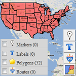
- Map of USA states
- Visualize business sales data
- Data mining or marker clustering map
- Filter map markers by category
- Map with routes and multiple layers
- Store locator in France
- Generate maps from spreadsheet data
- ZIP code search on congressional map
- Present multiple database stats
- Density choropleth map
- Census data and demographics map
- Make an online interactive image map
- Route map of rally across provinces
- Crowd sourcing map
- Geographic regions on Google Maps
- Driving routes between locations
- Annotated Interactive Metro Map
Interactive map solution
HTML5 map solution
Interactive Floor Plan Maps in Flash/ HTML5
Showcase > Flash / HTML5 Mapping Solution >
Floor plans give you view of rooms and spaces to show how they are arranged. Physical objects can also be drawn on floor plans to represent their layout on each level of buildings. Interactive floor plans can be created by using your own plan images, by importing into iMapBuilder Online (Flash) or iiCreator (HTML5).
We can also create tailored floor plan systems in Flash or HTML5 with the following features:
- Import your floor plans to create plan templates for interactivity.
- Add points and draw polygons over the plans to annotate the rooms, booths, spaces and physical objects.
- Information boxes to reveal details of each object.
- Interactive & annotated floor plans can be published as standalone plans or embedded into web pages.
- Database connectivity to drive dynamic information on floor plans.

Usage Scenarios
- Trade show organizers can use an interactive floor plan as a rich locator map for exhibitors, with their details shown upon selecting a booth/ room.
- Event organizers can use the system to manage vacancies of venues. Real time floor plans can show the current occupancies, and heat maps can be generated from occupancy data to maximize usage of venues.
- Malls can use these floor plan maps as shop locators.
- Hospitals can integrate the plans with medical data to show directions to wards or consultation rooms.
Video Tutorials for Making Flash Maps
For those users who have no idea of creating interactive flash maps, please take a few minutes to watch the online video tutorials!
Cloud-based Interactive Map Creator
and Image Mapping Tool
Create interactive map, image map, custom Google map with on line editor
- Ready-made map templates of countries & world, easily edit maps in browser
- Feature rich custom style Google map editor: marker clustering & crowdsourcing
- Turn an image into interactive diagram, floor plan, flow chart
New! iMapBuilder - Interactive HTML5 Map Builder
Creates HTML5 interactive maps for iPad, iPhone, PC, Mac & Android mobile
- Created maps work on PCs, Macs, iPad, iPhone, Android mobile and tablets
- Customize map styles (e.g. color themes) easily using software editor
- Embed maps in web page for online or offline presentation
- Simple, flexible licensing for developers and businesses
 Scalable & Zoomable Map |
 Cross Platform Support |
 Styled Rollover Info Box |
More info about interactive HTML5 map development Contact Us


